Top Treks in Patagonia
 by Kathy Jarvis on 16th October, 2024

What Are the Top Treks in Patagonia?
Discover the top treks in Patagonia, as picked by Andean Trails’ director, Kathy. She’s been exploring Patagonia’s vast wilderness for more than 25 years.
Here are her top treks in Patagonia, surrounded by fabulous mountains, sparkling glaciers, and welcoming hosts.
Top Treks in Patagonia: How to Choose?
Patagonia is a 260,000 square mile/673,000 square kilometre scrub plateau covering southern Argentina and parts of Chile. Hikes occur in remote areas, and pinpointing where you wish to trek is essential.
Here are a few steps to ask yourself before deciding where and how to trek:
- Day treks or longer trails?
- Highlights or off-the-beaten-track wilderness?
- Camping or a bad every night?
- Budget: guided or self-guided makes a big difference.
- Landscapes: glaciers, peaks, forests, or steppe?
What Are the Best Hiking Areas in Patagonia?
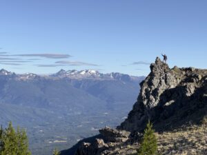
Patagonia highlights include impressive mountains, vast calving glaciers, and pristine, rushing rivers. Destinations for hiking include:
- Torres del Paine National Park in Chile
- Los Glaciares National Park in Argentina
- Cerro Castillo in Chile’s Aysen region
- Montes Martial Trek, Ushuaia, Argentina
- Navarino Island, Magallanes Region, Chile
Here are Kathy’s top treks in Patagonia.
Top Treks in Patagonia: Chile’s Torres del Paine National Park
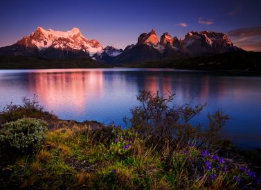
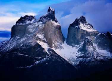
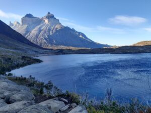
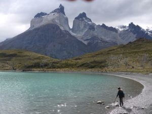
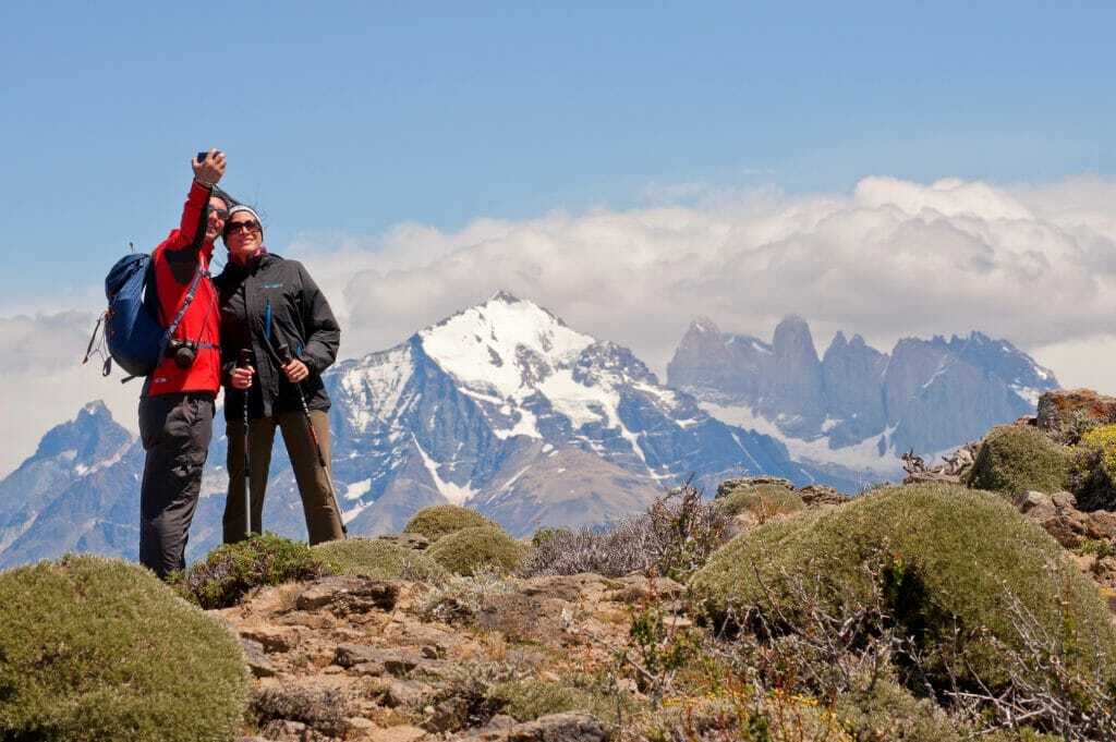
There is nowhere better for glacial lakes and rivers in all shades of blue, vast mountain scenery and plentiful wildlife. At the heart of the park is the Paine massif, with the centrepiece being the three granite spires of the towers, the south tower reaching 2,500 metres high.
The Paine W is a multi-day trek that includes three of the best walks in Torres del Paine National Park, one of Chile’s largest and most visited parks.
The Paine W: Facts and Figures
- Distance: 51km/32miles
- Time: 5-6 days
- Difficulty: Moderate
It is usual to trek the Paine W over five days, walking from southwest to northeast or vice versa.
From southwest to northeast, the first full day’s walking is alongside the iceberg-filled Lake Grey. There are beautiful views along the lake to Glacier Grey, which flows off the south Patagonian ice cap.
The French Valley comes next, and a hike up through the southern Beech forest takes you into an amphitheatre of incredible granite mountains.
There are the immense walls of Cerro Cota 2000 and Cerro Catedral, the granite arête Aleta de Tiburón (Shark’s Fin), the Fortaleza (Fortress), La Espada (The Sword), La Hoja (The Blade), La Máscara (The Mask), the three iconic Torres (Tower) and the weirdly eroded Cuernos (horns).
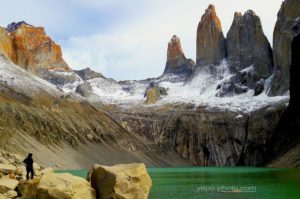
The third classic walk is up the Ascencio Valley to the base of the Towers for the iconic picture in front of the mountains and its glacial lake. On a fine day, the views will be outstanding.
Paine W: Trekking Options
There are several ways to hike the Paine W. These include:
- Guided or self-guided 5-day trips, camping or staying in mountain refugios housing 6-8 people in bunks.
- An eco-camp-based 5-day or 7-day version featuring cosy domes and mountain refugios.
- A self-drive with various day walks from a hotel.
- An all-inclusive stay at Hotel Las Torres with day treks to the Towers of Paine, the French Valley, and Grey Glacier.
- Go for the longer, 9-day Paine Circuit (see below for more).
The Paine Circuit: The Torres Challenge
- Distance: 134 km/83 mi.
- Time: 9 days
- Difficulty: Strenuous
For those with more time—nine days are required—the Paine Circuit is even better than the Paine W. It circumnavigates the whole Paine massif and takes in the highlights of the W trek described above. Due to the remote location, possible strong winds, and strenuous nature of the Paine Circuit, we recommend a guided hike.
Experience quiet trails on the backside of the Torres del Paine Mountain range with incredible views of the South Patagonia Ice Cap. Remote campsites provide your base, surrounded by mountains, and there’s the challenge of the John Gardner Pass (1,200m/3,937ft), the highest trekking point in Torres del Paine.
The area is rich in wildlife. Herds of Guanacos are common throughout the park, and foxes and pumas can be seen, though less often. The elusive Chilean Huemul also lives here. There are 15 bird of prey species, including numerous Andean condors, black-chested buzzard-eagles, and rufous-tailed hawks.
Other notable creatures include the Chilean flamingo, Darwin’s rhea, black-necked swan, Magellanic woodpecker, various geese, and buff-necked ibis.
Top Treks in Patagonia: Los Glaciares National Park, Argentina
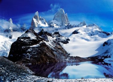
Fitz Roy Mountain and Cerro Torre, on the Argentinean/Chilean border, are well known to mountaineers as highly technical climbs that are exposed to extreme weather for much of the year. Both are granite spires that stretch up from the vast ice cap, the Southern Patagonian Ice Field.
The region has several fantastic hikes, from day walks to extreme glacier expeditions.
Fitz Roy M Trek
- Distance: 48km/30miles
- Time: 4 days
- Difficulty: Moderate
The Fitz Roy M walk – named for the route’s M-shape – takes in the best of Fitzroy National Park in Argentina.
You hike to the stunning mountains of Fitz Roy and Cerro Torre, walk on glaciers, and explore Los Glaciares National Park. You stay at remote campsites and refugios among pristine forests. For the adventurous, Cerro Madsen offers an exhilarating climb.
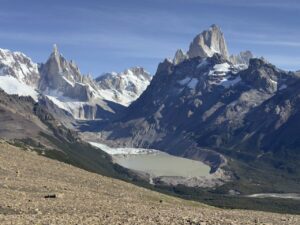
Highlights include Río Electrico, Laguna Torre and the beautiful Cerro Torre mountain. Laguna de Los Tres offers an unrivalled view of the entire Fitz Roy range.
Fitz Roy Highlights from El Chalten
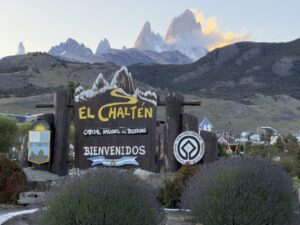
You can also undertake guided or self-guided day walks from El Chalten, nestled between the Patagonian steppes and the Patagonian Andes, to ensure the very best views of these iconic peaks.
Spend the day in Patagonia’s wilderness, with the comfort of a good night’s sleep in a hotel every night.
The trails are well-marked. The three recommended walks, each special in its own way, are the walk to Laguna de Los Tres at the base of Fitz Roy, a shorter trail to the base of Cerro Torre, and a long, rewarding day hike up the ridge of Loma del Pliegue Tumbado.
Views from each are spectacular, and whether you are a climber or not, you will be able to appreciate these magnificent mountains and the difficulties faced by those who dare to try to scale their icy heights.
The walks can be done with a guide with expert knowledge. They can tell you about the flora, fauna, geology, and history, or you can go self-guided.
These can be included in our self-guided Patagonia itinerary.
Laguna de los Tres
- Distance: 25km/15.6 miles
- Time: 7-10 hours
Trek to the foot of Mount Fitz Roy (3,441m/11,289ft) to Laguna de los Tres. This spectacular granite peak, named in honour of the captain of the Beagle, the ship Charles Darwin sailed on in the 1830s, reaches two miles into the sky and was first climbed in 1953. It is one of the best viewpoints in the park.
Loma de Pliegue Tumbado Trail
- Distance: 21km/13 miles
- Time: 8-10 hours
Set off from the Ceferino Fonzo Visitor Centre, heading uphill to a lookout point 1,500m/4,921ft above sea level.
The trail will take you along a plain through a wood, with the final ascent to the summit along a trail marked with yellow-topped poles. In favourable weather conditions, the views from the top are some of the best you will see in the area.
It’s a good 8-10 hour round trip walk, depending on your trekking speed (total distance: 21km, 13 miles).
Laguna Torre
- Distance: 19km/12 miles
- Time: 7-8 hours
Walk the Torre trail to Laguna Torre to reach Cerro Torre (3,128/10,262ft), a sheer, needle-shaped mountain which was once rated unclimbable and conquered only after Everest.
South Patagonia Ice Field Trek
- Distance: 89km/55miles
- Time: 7-10 days
- Difficulty: Strenuous
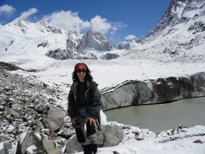
Behind the Fitz Roy massif lies the Patagonian Ice Cap. A traverse across this vast expanse of ice remains one of Patagonia’s most beautiful, remote, and demanding challenges.
The ice field is the third largest single expanse of ice on earth, exceeded only by Antarctica and Greenland. Spend days amid towering granite spires and massive glaciers that very few see.
Every team member carries food, equipment, and determination with consecutive hiking days on ice using crampons and snow shoes. Three mountain passes are the reward: The Marconi pass, Paso del Viento, and the Huemul pass too.
This is one of Patagonia’s most challenging treks. It is way off the beaten track, in a true wilderness where few have stepped.
Huemul Circuit Trek
- Distance: 70km/43miles
- Time: 4 days
- Difficulty: Moderate to strenuous
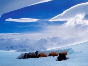
The Huemul Circuit, pronounced way-mool, is a short, epic, and challenging hike.
Like the Ice Cap, trekkers must carry all their gear through remote areas of Los Glaciares National Park. Highlights include views of the South Patagonia Ice Cap and the chance to hike on the Túnel Glacier. Want more? There’s a Tyrolean traverse, two passes, forests, meadows, glacial moraines, and wild campsites next to iceberg-strewn lakes.
The Huemul is Patagonia at its rawest and most authentic.
More Top Treks in Patagonia
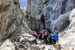
Less well-known but equally beautiful are the following walks.
Villa O’Higgins to El Chalten
- Distance: 25km/16miles
- Time: 1-2 days
- Difficulty: Moderate
At the southern end of the Carretera Austral in Chile lies the small town of Villa O’Higgins, a top spot for walks. The crossing from Villa O’Higgins to El Chalten is a wonderful way to get from this remote part of Chile into the Fitzroy area and El Chalten in Argentina.
There is no road connection this far south. The journey, a combination of boats and walking, is best done over two days or more. There are plentiful trails in the area, and if you have time and the kit, you can explore this relatively unknown off-the-beaten-track region of lakes and mountain peaks.
Cerro Castillo, Aysen Region, Patagonia, Chile
- Distance: 51km/32miles
- Time: 3-4 days
- Difficulty: Moderate to strenuous
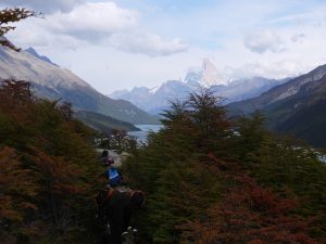
If you are travelling down the Carretera Austral, we highly recommend you stop en route to take a day to walk up Cerro Castillo in Chile’s Aysen region. If you have the camping equipment and enough time, you can trek in this area for several days.
You can do a day hike from Laguna Cerro Castillo or take on the four-day hike. There are fewer people here than in Torres del Paine National Park.
One starting point is Valle de la Lima. The Cerro Castillo trek takes the hiker past beautiful forests, mountain rivers, and turquoise lakes. En route to Cerro Castillo village, you’ll see the hanging glaciers and fantastic mountains.
Take care with the climate here: snow is not uncommon, and rain is likely. There are many ascents and descents, so make sure those knees are in good shape. There are only basic campsites. Cerro Castillo is for hiking and adventure lovers, as is the entire Aysen region.
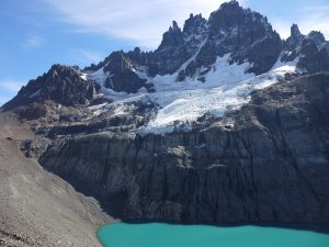
Los Dientes de Navarino, Navarino Island, Magallanes Region
- Distance: 37km/22miles
- Time: 4-5 days
- Difficulty: Strenuous
Los Dientes de Navarino, or Navarino’s Teeth, lies near Cape Horn, close to the iconic Ushuaia but firmly in Chilean territory.
The climate here can be harsh, but the rewards are remarkable for the determined trekker. Expect strong gusts, rain, and perhaps snow in a heady mix of ocean and mountain weather. Underfoot, you may encounter boggy land, rough moraine, and steep descent.
Remote valleys, dramatic peaks, and tough walking await. Distances are short, but conditions make up for the missing miles. Highlights include Cerro Bandera and Laguna del Salto, with the peaks that give the range its ‘teeth’ name another. Views of Cape Horn, the tip of the American continent, complete the trek’s attractions.
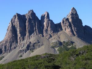
Walking and Trekking from Ushuaia
At the very end of the land mass that is South America lies the fascinating historical town of Ushuaia. The Andes change direction here and plunge into the sea, the Beagle Channel.
I have three favourite walks here:
- Montes Martial is in the hills behind the town, rugged and remote, and you can go guided or self-guided.
- Along the coast in Lapataia National Park with its greenery, gentler terrain and plentiful wildlife.
- Summit Cerro Guanaco
In Lapataia, you will see various types of Patagonian geese, the Magellanic woodpecker, flightless steamer ducks, diving petrels and black-browed albatrosses, possibly even sea otters, inland guanacos, Patagonian grey foxes, southern river otters and the introduced Canadian beavers and European rabbits.
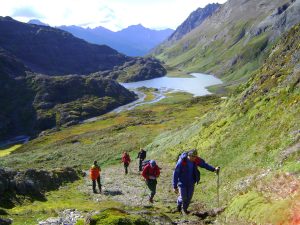
Walking and Trekking Near Bariloche
In the Argentinean lake district lies the chocolate box town of Bariloche. It is a busy ski station in the winter and an excellent jumping-off point for walks in the summer. This is one of the only mountain areas in Argentina with mountain huts.
The huts are basic, and I wouldn’t particularly recommend them, but with long daylight hours, it is possible to walk into the heart of the mountains on a day. I recommend the hike from the ski station up to Refugio Frey, which is at the foot of Cerro Catedral.
FAQs about the Top Treks in Patagonia
Do I Need a Guide for Patagonia Hikes?
Torres del Paine and Los Glaciares National Parks are well-signposted and suitable for experienced trekkers to hike independently.
A guide will explain an area’s flora, fauna, geology, and history as you walk. A guide is essential for safety on some trails, such as Huemul, South Patagonia Ice Cap, Los Dientes de Navarino, and many others.

When’s the Best Time to Hike in Patagonia?
The prime trekking season is from November to March. Some areas, like Torres del Paine and Los Glaciares National Parks, run more from September to April. Indeed, Torres del Paine is open during the Chilean winter (May to August), albeit with short and cold days.
December to February sells out a long way in advance, and planning is necessary for many Patagonia treks. Check our weather guide for more.
Are There Any Altitude Issues on Patagonia Hikes?
Hardly any trails rise above 1,500m/4,920ft in Patagonia, so no acclimatisation is required before trekking.
Are There Toilets on Patagonia Hiking Trails?
Paine W campsites have toilets, some basic and others flush toilets. Los Glaciares National Park toilets are basic drop latrines.
In most other areas and between campsites, be prepared to go to the toilet in the wild. Remember to carry out anything you take in and to be at least 100m from water sources.
Top Treks in Patagonia
These are a few of the top treks in Patagonia. If you would like more information on a Patagonia trekking holiday get in touch with Andean Trails.
Share


 a Tailor Made Tour

 a Group Tour